Comparing Mersey Sailing Clubs: Which One Fits Your Skill Level and Budget?
October 13, 2026 - River Life
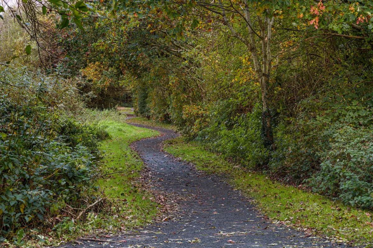
The Wirral Way follows the trackbed of a railway that closed to passengers in the 1950s, running roughly twelve miles along the western edge of the peninsula from West Kirby down to Hooton. Because it was built for trains, it is almost entirely flat, and because it is no longer a working line, it is almost entirely traffic-free. Two features that make it unusually forgiving for a first long walk.
It is also surprisingly easy to get wrong. People set off in February in trainers with one small bottle of water, hit half a mile of clay paste near Heswall, and spend the rest of the day wishing they hadn't. A little planning turns a good route into a genuinely great day out.
The Wirral Way runs the length of Wirral Country Park, which opened in 1973 and is often described as Britain's first country park. It is a shared route: walkers, cyclists and horse riders all use it, and you will meet all three. Nobody has priority in any meaningful sense, so keep left-ish, listen for bells and hooves, and don't walk three abreast when a group is coming the other way.
The surface is mostly compacted gravel, with stretches of tarmac. It is not a rugged trail, but it is not a pavement either. Expect tree roots, uneven edges, and puddles that survive for days after rain. The route is waymarked and signed at the main junctions, and there are distance markers along the way, though a phone map is worth having for the couple of spots where paths cross and it isn't obvious which way to turn.
Both ends of the trail sit next to railway stations, which is the single most useful fact about the Wirral Way. It is a linear route, not a loop, so unless you fancy walking twelve miles and then twelve miles back, you want a train at one end.
From West Kirby the path runs beside the marina and out towards Caldy, with the Dee estuary and the Welsh hills opening up on your right. The views across the water are the reward for the flatness — on a clear day you can pick out the North Wales coast without much effort.
Thurstaston is the hub. The visitor centre sits just off the trail, and Thurstaston Hill, with Thor's Stone at the top, is a short climb away if you want a proper view back over the estuary. Beyond that comes Heswall and the Heswall Cutting, a deep sandstone gorge that the railway carved through the ridge. It's the most dramatic section of the route and the one most people photograph.
Further south the path passes Gayton and Willaston before dropping down to Hooton, running through a quieter, more enclosed landscape of hedges and fields. The trail also passes within a short detour of Parkgate's promenade, which is worth adding on if you have time and legs left.
Facilities are concentrated rather than spread out. Thurstaston Visitor Centre has toilets and a café, though opening hours change with the season, so don't build your day around a hot lunch unless you've checked. West Kirby and Hooton both have shops and cafés near their stations. Between those points, expect benches and bins rather than taps and tearooms, and carry more water than you think you need.
Now, the mud. Sections of the Wirral Way sit on heavy clay, and after sustained rain they hold water. The stretch around Heswall and the cutting is the usual offender, with Willaston not far behind. In summer this is a non-issue. In winter it can mean ankle-deep slop for a mile at a time.
If you're new to the route, don't start with the full twelve miles. Park at Thurstaston, walk north to West Kirby — around five or six miles, with the best of the estuary views and a train station and cafés at the end. Once you've done that, come back and do Thurstaston to Hooton, then join the two together when you know how long you take and how the surface behaves.
Start early, take layers, water, food and a waterproof, and check Merseyrail times before you leave rather than on the platform. Tell someone where you're going and roughly when you expect to be back. If you have a heart condition, joint problems or you're returning to walking after a long break, have a word with your GP before attempting the full distance — this is a gentle route, but twelve miles is still twelve miles.
Do that, and the Wirral Way rewards you with something rare in the north west: a long, quiet, genuinely flat day out with a train at each end and the Welsh hills across the water the whole way.
Photo: Irek Marcinkowski / Pexels

From tide-dependent estuary berths to sheltered Wirral lake sailing, Merseyside's clubs differ sharply on cost,...

The Mersey Tunnels have linked Liverpool and Wirral since 1934. Here is how Queensway and Kingsway were built, and...
Copyright © 2026 The Mersey Corner. All Right Reserved.